SEVERE WEATHER:ALERTS AND TRACKING
Current Condition Observation Alerts
- Alert notifications of severe weather events based on thousands of global, real-time current condition reports.
- Alerts are issued against standard criteria or customized for client requirements.
Forecasted Significant Weather
- Forecasted Significant Weather highlights areas with the most significant weather as compared to climatology.
- Created to be used in conjunction with Severe Weather Advisories.
- Forecasted Significant Weather uses a ranking of 0-100 to indicate the significance of weather in a particular location with a focus on precipitation, winds, and temperature.
SEVERE WEATHER ADVISORIES
Global Severe Weather Advisory System
- Our advisories inform people around the globe of potentially dangerous or severe weather conditions in their local area Before they happen.
- Advisories are updated four times daily and are available for 80,000+ worldwide locations.
- Advisories cover the next 24 hours.
- Options for upcoming 6 hours, 48 hours, and upcoming 5 days are also available.
Example Includes:
- Precipitation
- Lightning Strider Alerts (US only)
- High winds
- Freeze alerts
- Ice accretion
- Extreme heat alerts
- Hail potential
- Tornado potential
- Surf alerts
- Tropical storm updates
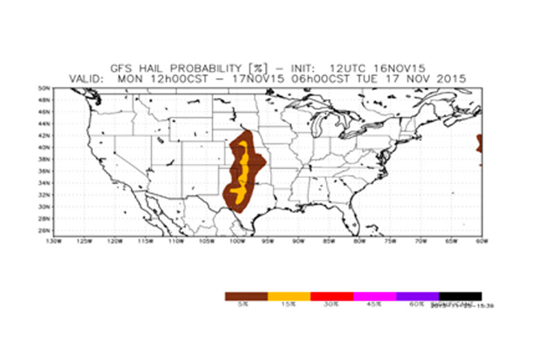
Real-Time Hail Tracking
- Track the size and movement of storm cells containing hail based on Doppler Radar signature
- Provides the probability of hail associated with a storm cell
- Indicates the maximum hail diameter reported
- Available through our API in XML format
- Data also available in a map tile interface with scroll-overs for additional detail
Hail Forecast (Global)
- Hail forecast is available as a Cloud Weather Service (CWS) plug-in.
- Forecast for a probability of significant hail is available out to 7 days.
- The criteria for significant hail has been defined by the Storm Prediction Center
Flood Risk
- Globally available flood risk is based on past, current, and future precipitation compared to typical during a given period.
- Precipitation observations and forecasts are dynamically integrated over time to capture flood potential as it relates to given conditions across the landscape.
- Flood forecasts are available day-by-day at 10km with regional scales to 1km.
- Flood risk is broken into 5 categories – Low, Moderate, High, Very High, and Severe.
- Data can be delivered as kmz/kml, map tile, geojson, or geotiff/shapefile/geopackage.
Icing Forecasts
Icing index for any global location is available Cloud Weather Service.
Variables include:
- Surface forecasts for categorical freezing rain
- Categorical ice pellets
- Percentage frozen precipitation
- Frozen rain
- freezing rain
- highest tropospheric freezing level geopotential height
- 0°C isotherm geopotential height
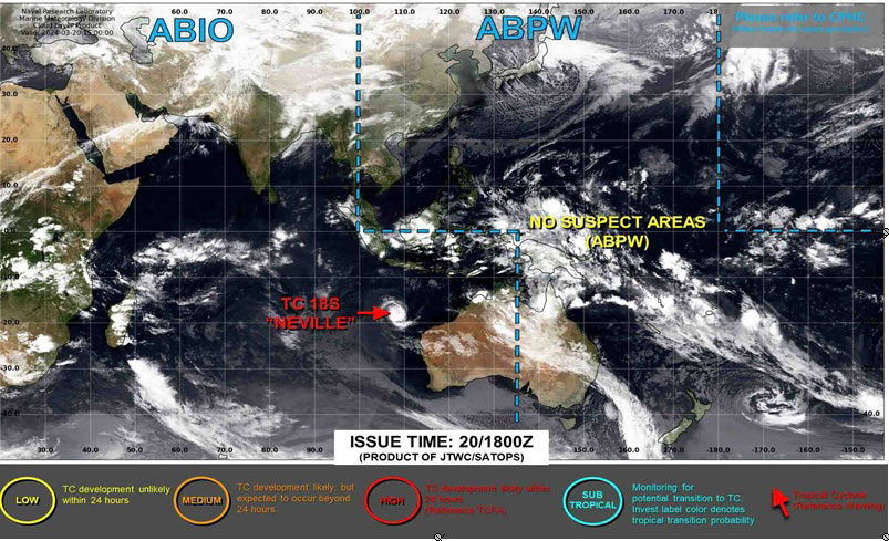
HURRICANE TRACKING
Hurricane Tracking Includes
- Current movement and minimum central pressure
- Forecasted storm positions
- Forecasted wind speeds, wind gusts, wind radiia
- Forecasted wave radii
- Forecasted conditions are provided for the upcoming 72 hours